Your Shopping Cart is empty.
INPA0506127
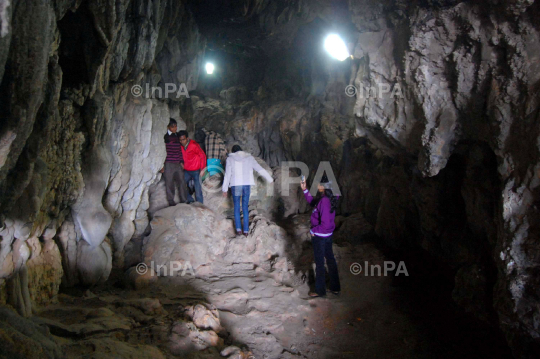
Travel: Tourists visit the famous Mawsmai cave in Cherrapunjee in Meghalaya on June 5, 2012. Cherrapunjee is a small town located on the southern edge of Khasi Hills, at an altitude of about 4823 feet (1484 m) above mean sea level. Cherrapunjee is locally and now officially known as ëSOHRAí. Khasi people of Mon-Khmer origin inhabit it. It is the headquarters of Sohra Civil Sub-Division and falls in East Khasi Hills District of the Indian State of Meghalaya. Meghalaya is one of the seven states of North East India with Assam to its North and sharing an international border with Bangladesh on its South. Photo by Luit Chaliha/Indian Photo Agency
Travel: Tourists visit the famous Mawsmai cave in Cherrapunjee in Meghalaya on June 5, 2012. Cherrapunjee is a small town located on the southern edge of Khasi Hills, at an altitude of about 4823 feet (1484 m) above mean sea level. Cherrapunjee is locally and now officially known as ëSOHRAí. Khasi people of Mon-Khmer origin inhabit it. It is the headquarters of Sohra Civil Sub-Division and falls in East Khasi Hills District of the Indian State of Meghalaya. Meghalaya is one of the seven states of North East India with Assam to its North and sharing an international border with Bangladesh on its South. Photo by Luit Chaliha/Indian Photo Agency
